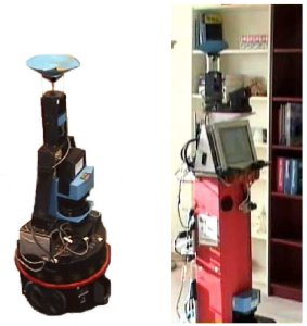
navigation among and communication with humans
The aim of my phd was to give a mobile robot the ability to build and maintain a spatial representation (map) of its environment. This map was not only meant to be used for robot navigation, but also for spatial reasoning and communication with humans. Therefore, the map should contain "high-level" knowledge.
The spatial representation I used was a topological map, consisting of a graph of nodes and links. Each node represents an image and a link between two nodes denotes that the corresponding images were taken from the same part of the environment. Extra information in the form of labels, such as "Kitchen", were added to the nodes of this graph. We tried to use graph clustering techniques to divide the graph in separate subgraphs, for which each belongs to a single room. The given labels can then be generalized over these subgraphs. This clustering method was described in a workshop paper at IROS 2006, and later published as a journal paper in Transactions on Robotics in 2007. Together with the Applied Computer Science group from the Bielefeld University, we integrated this topological map method with a spoken dialog system, which we also presented at iros 2006.
Up to then the graph building and clustering were performed offline (actually not even on the robot-pc). For robot-navigation and especially human-robot communication we had to build real-time versions of the software. In an icra paper 2007 (later that year copy pasted as an asci paper) we showed that non-geometrical map could be used for vision based robot navigation, even with humans walking next to the robot (see also this video). In an RSS workshop paper in 2008 we again presented an integration paper, which combined the spoken dialog system of the Applied Computer Science group from the Bielefeld University and the connected dominating set method. For this workshop I also made a video explaining our approach.
I copy pasted these last two papers in my PhD thesis as appendices.